Drone Surveys
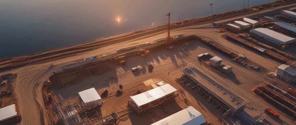
This blog looks at how drone technology is changing the way utility and infrastructure projects are inspected and monitored. From reducing the need to work at height to giving teams quicker access to accurate site data, UAV surveys are helping improve safety, efficiency, and project visibility across the utilities sector. The article also explores how drones are becoming a valuable tool for inspections, progress tracking, and infrastructure management.
SURVEYS

How Drone Surveys Are Changing Utility Infrastructure Inspections
A few years ago, drone surveys were still seen as something fairly new within the utilities industry. Now, they’re becoming a normal part of how infrastructure projects are planned, inspected, and monitored.
And it’s not hard to see why.
For utility contractors and asset owners, getting clear and accurate information from site has always been important — but traditional inspections can sometimes be slow, expensive, or difficult to carry out safely. Whether it’s accessing rooftops, inspecting long pipeline routes, or checking hard-to-reach structures, there are often risks and limitations involved.
Drone technology is helping change that.
At INFINITY Eng, we see UAV and drone surveys as a practical tool that can improve visibility on projects, support safer inspections, and help teams make better decisions using real site data.
What Is a UAV Survey?
UAV stands for Unmanned Aerial Vehicle, although most people simply call them drones.
Using high-quality cameras and imaging technology, drones can capture photographs, video footage, mapping data, and site information from the air. This allows engineers and project teams to inspect areas quickly without needing to physically access every location themselves.
Drone surveys are now being used for things like:
Pipeline and utility route inspections
Roof and structural inspections
Construction progress monitoring
Site condition surveys
Thermal imaging
Environmental monitoring
Asset condition assessments
In many cases, drones can provide a much clearer overall picture of a site than traditional ground-level inspections alone.
Why More Utility Projects Are Using Drones
One of the biggest advantages of drone surveys is the improvement in safety.
Traditionally, inspections may have involved working at height, temporary access equipment, road closures, or even shutting down parts of a site to gain access safely. Drones can often reduce the need for that entirely.
They also help teams gather information much faster.
Instead of spending hours accessing difficult locations manually, a drone survey can often be completed in a fraction of the time while still providing detailed visual records that can be reviewed later.
Some of the main benefits include:
Reduced working at height
Faster inspections
Better access to difficult areas
Less disruption to live sites
Improved visual records and reporting
Better project visibility
Safer data collection overall
For utility projects operating under tight programmes, that extra efficiency can make a real difference.
Utility Sites Are Rarely Simple
Anyone who works in utilities knows that infrastructure inspections are rarely straightforward.
You could be dealing with remote pipeline routes one day and heavily congested urban environments the next. Access can be limited, structures can be difficult to inspect safely, and project teams are often working around live assets and public areas.
Drone technology helps bridge some of those challenges by giving teams a safer and more flexible way to understand site conditions without increasing risk unnecessarily.
It’s also becoming increasingly useful for monitoring construction progress and recording site conditions throughout a project lifecycle.
Drone Surveys Still Need Proper Planning
Although drones make inspections easier in many ways, they still need to be operated properly and safely.
UAV operations within the UK must comply with Civil Aviation Authority (CAA) requirements, and surveys should always be carried out by competent operators with suitable planning and controls in place.
That includes things like:
Flight planning
Risk assessments
Airspace checks
Safe operating procedures
Site controls
Data management processes
Like any other activity on a utility project, good planning is what makes the operation safe and effective.
How INFINITY Eng Is Using UAV Technology
At INFINITY Eng, we’re continuing to develop UAV capability to support utility and infrastructure projects across the UK.
Drone surveys can support a wide range of engineering and inspection activities, including:
Utility inspections
Construction progress tracking
Temporary works monitoring
Site condition assessments
Infrastructure documentation
Used properly, drone technology can provide valuable insight that supports both project delivery and long-term asset management.
Final Thoughts
Drone surveys are quickly becoming part of the future of utility infrastructure inspections — not because they replace engineering expertise, but because they help teams work smarter, safer, and more efficiently.
As projects become more data-driven and safety-focused, UAV technology offers a practical way to improve visibility, reduce operational risks, and capture better information from site.
For utility contractors and infrastructure owners, that can mean safer inspections, quicker decision-making, and a much clearer understanding of project conditions from start to finish.
If you’re interested in UAV support for utility projects or infrastructure inspections, INFINITY Eng is always happy to discuss how drone technology can support your project.
Any Questions?
sales@infinityeng.co.uk